← All work
Tools & Experiments · Live

Ridgeline

7-Day Hiking Conditions Forecast

Not the weather — whether the hike is a good idea, scored by elevation band.

Open the live project →

Status
Deployed and public
Timeframe
July – August 2026
Role
Sole author — scoring model, interface, deployment
Built with
React · Vite · Open-Meteo · NWS API · S3 + CloudFront
3
elevation bands per forecast
6
weighted scoring factors
7
days out

The question

A summit forecast and a trailhead forecast are different weather, and the gap between them is what catches people out. Standard forecasts give you one number for a point on a map. What a hiker actually needs to know is whether the day is worth taking off — which is a judgement across wind, precipitation, visibility and cold, at the altitude they will actually be standing.

What I built

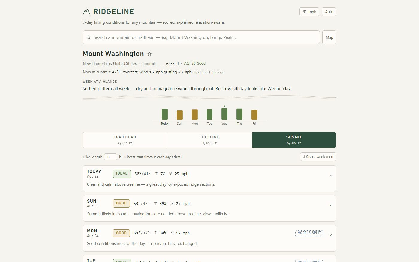
A forecast that scores conditions Poor / Fair / Good / Ideal for any mountain or trailhead, seven days out, across trailhead, treeline and summit bands — with official National Weather Service alerts layered on top.

Each day gets a 0–100 composite from six weighted sub-scores: precipitation at 30% with snow penalised harder than rain, wind at 25% from summit sustained speeds and gusts, temperature and wind chill at 15% penalising both cold and heat, and summit visibility at 15%. Wind, temperature and visibility are computed against the summit band; heat against the trailhead.

Entirely static — no backend, no API keys, no login, nothing secret in the bundle. Both data sources are free, key-less and CORS-enabled, so every fetch happens in the browser.

The hard part — A composite score has to be legible, or it is just a number

The failure mode of any weighted index is that it produces a confident figure nobody can interrogate. A 62 is useless if you cannot see that it is a 62 because of summit gusts rather than rain — those call for completely different decisions.

So the weights are published, the sub-scores are visible, and the elevation band each factor was measured at is stated. The score is an entry point into the underlying forecast rather than a replacement for it.

What this does not tell you

  • NWS alerts are U.S.-only; the underlying forecast is global.
  • Elevation bands are modelled from the summit and trailhead elevations, not from on-mountain sensors.